|
PAGE 6
All Rights Reserved. Copyright © 2004-2011
OABONNY / Click thumbnails for
full-size pics, BACK to return to this page.
|

Taken on
05/31/05, picture courtesy of ScannerMan
House, County Route 189, hamlet
of Lorraine


According to 'MidnightMoose' this house is being renovated. |

Taken on
06/05/05, picture courtesy of ScannerMan
Top of first State Street Hill


RollingMarch
writes "Lately as I've gone up and down State St hill (near Watertown) I've
noticed the barn has been fixed up. Haven't seen any action on the house yet tho." |
|

Taken on
06/15/05
Remains of old mill outside of Herrings There are a number of buildings
and ruins, but it is well grown over and surrounded by fencing so I could not
get very good shots.

Note - much of the brush has now
been cleared, see this page for clearer pictures. |

Taken on
06/15/05
Remains of old mill outside of
Herrings

Note - much of the brush has now
been cleared, see this page for clearer pictures. |

Taken on
06/15/05
A very old house between Copenhagen
and Carthage, on Route 12
The barn seemed to be much newer and partially in
use and well-kept, possibly by local Amish?


On
3/25/12 Bzzzcat wrote "What is that anomaly in the sky to the left of the house?
It looks like a ghost. A flapper perhaps." Webmaster note - I belive this was
a reflection off the window of the car I took this through. |

Taken in late 1990's
Flooded remains of old mine,
White Rock Quarry,
between Natural Bridge and old Lewisburg. Called Quarry Pond.
In the Fall of 1906 the lime quarry had been in use
for a number of years and had been excavated to sixty feet. While more digging
was being done a wall fell, revealing an opening ten feet wide and four feet
tall and twenty feet deep. The hole was filled with giant calcite crystals, some
as large as nine feet tall, the largest ever found. New York State's assistant
state geologist was contacted and a project was put together to careful remove
the crystals and move them to Albany, where they were displayed in the New York
State Museum’s Crystal Cave exhibit. During the late 1930's the mining had dug
well below the water table and the mine was quickly flooded with water. In more
modern times Lewis County rescue divers went to the quarry to practice their
skills, and found the opening of the Crystal Cave, as well as a wooden platform
inside it - probably used to carefully remove the crystals for shipping to
Albany. They also found the remains of an old car, a flywheel for a steam
shovel, a system of railroad tracks, and a railroad car. This location is now a protected historic site. See also "Remains of Smelter" on page 4.
For the history of Lewisburg and other lost villages see the
Jeffco history page.


Google satellite
photo of the pond (upper one in photo)

Jacks S. writes "This is where the Rose Grotto was found the crystals were
removed to the state museum in Albany. The mine is 100 feet deep and the last
blast opened a spring three days later the mine was flooded." |

Taken on
07/22/05
Remains of a farm on Dickson Rd,
in Jefferson County near the border of St. Lawrence County
 |

Taken on
07/22/05
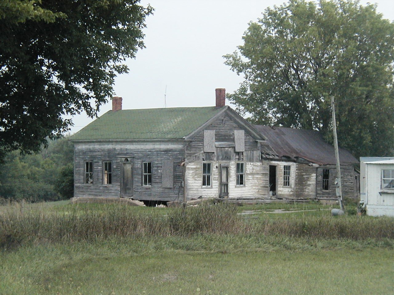
Old schoolhouse, looks like it may
have been a church at one time. Corner of Pikes Road, in St. Lawrence
County near Spragueville


From cshym74 (via
Flickr.com): "Good
shot of rural decay..."
From elisabethshroyer (via
Flickr.com): "Awesome building!"
From d. force: "This was a schoolhouse, my mother who was
born in 1932 attended this school when she was a child. I grew up in this town
named Spragueville."
On
6/29/12 Key writes "I don't believe the old school house was ever a church. My
neighbor went to school there back in the late 20's and 30's." |

Taken on
07/22/05
Burned out old barn, Quarry Road
outside of Gouverneur
 |

Taken on
07/22/05
Old house, part of an old farm, on County
Route 25, in St. Lawrence County near border of Jefferson. The barn (not
shown) was
still being used to store hay
 |

Taken on
08/29/05
Old barn, on Route 12E
between Clayton and Alex Bay
 |

Taken on
08/29/05
House on Route 180 near Omar
 |

Taken on
08/29/05
County Route 13 near Omar
 |

Taken on
08/29/05
County Route 13 near Omar, near
CR3 (?)
 |
 
[Home|Index of Buildings|Contact|Artwork|AnthonyFarm|Page1|Page2|Page3|Page4|Page5|Page6|Page7|Page8|Page9|Page10] [Page11|Page12|Page13|Page14|Page15|Page16|Page17|Page18|Page19|Page20|Page21|Page22|Page23|Page24|Page25]
[Page26|Page27|Page28|Page29|Page30|Page31|Page32|Page33|Page34|Page35|Page36|Page37|Page38|Page39|Page40] [Page41|Page42|Page43|Page44|Page45|Page46|Page47|Page48|Page49|Page50|Page51|Page52|Page53]|Page54|Page55] [Page56|Page57|Page58|Page59|Page60|Page61|Page62|Page63|Page64|Page65|Page66|Page67|Page68]

|